What Is Aerial Infrastructure 3D Planning?
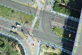
Aerial infrastructure 3D planning is detailed planning of urban development. A detailed study is done to plan development and every care is taken to make sure that the development work is carried out without disturbing the environment. It starts with accurate measurement of the land where development is planned and the land is surveyed with 360-degree images.
Visit us - https://kavmedidaseo.blogspot.....com/2024/08/what-is-
"Kav Medida is an industry-leader of Israel in the field of land surveying, geodesy, mapping and photogrammetry.
The company was established in 2012 and has been, since its inception, providing a variety of land surveying, mapping, and property line marking registrations. In 2018, KM acquired the “Road and Traffic Planning Company – Gabriel Lotan Engineers”, which has been operating for more than 50 years, specializing in physical road design solutions, traffic planning, and road drainage planning. The acquisition transformed KM into a group that offers as a one-stop shop, complete professional surveying services, alongside road design and route planning services. "


